Trail History
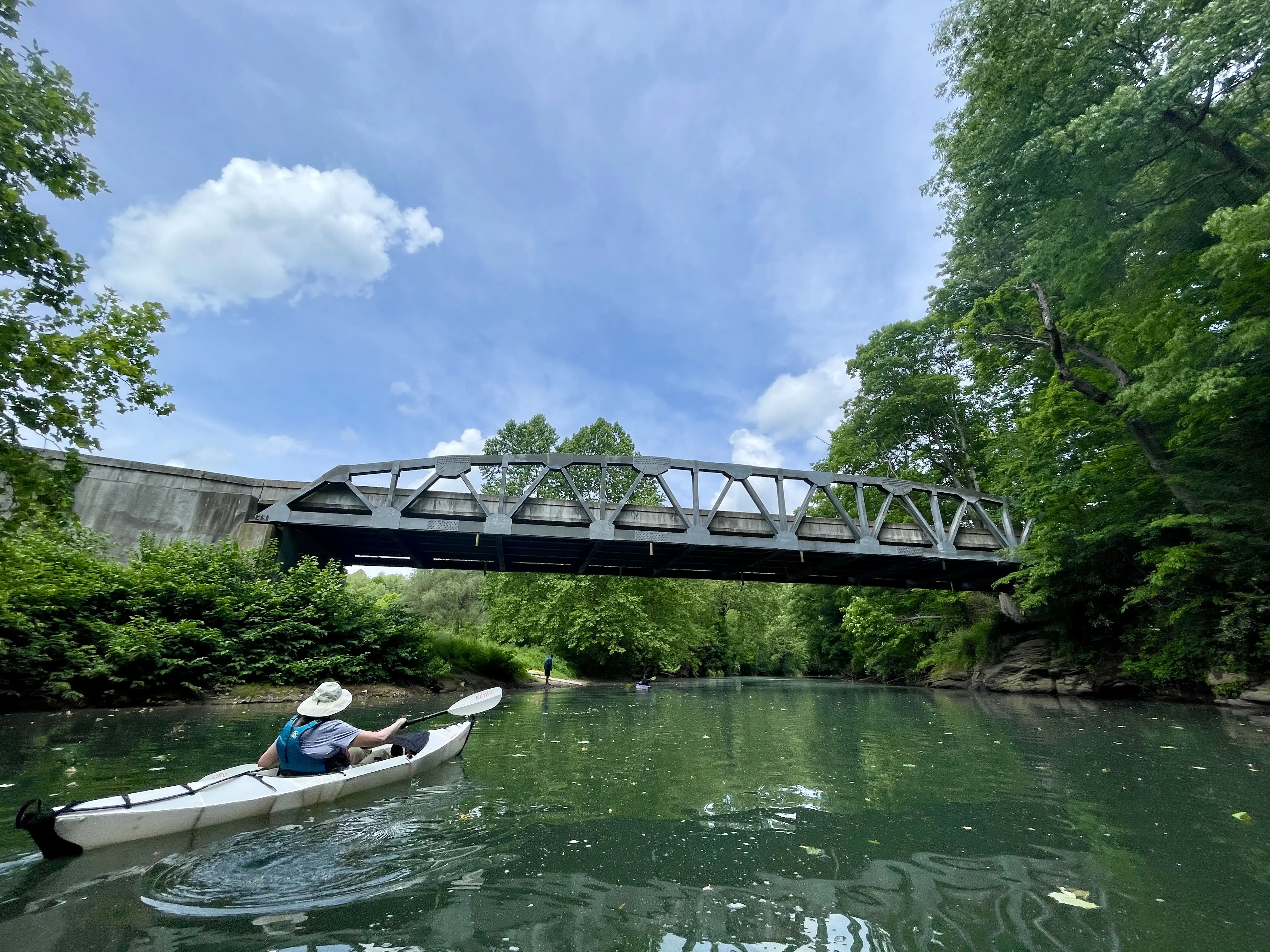
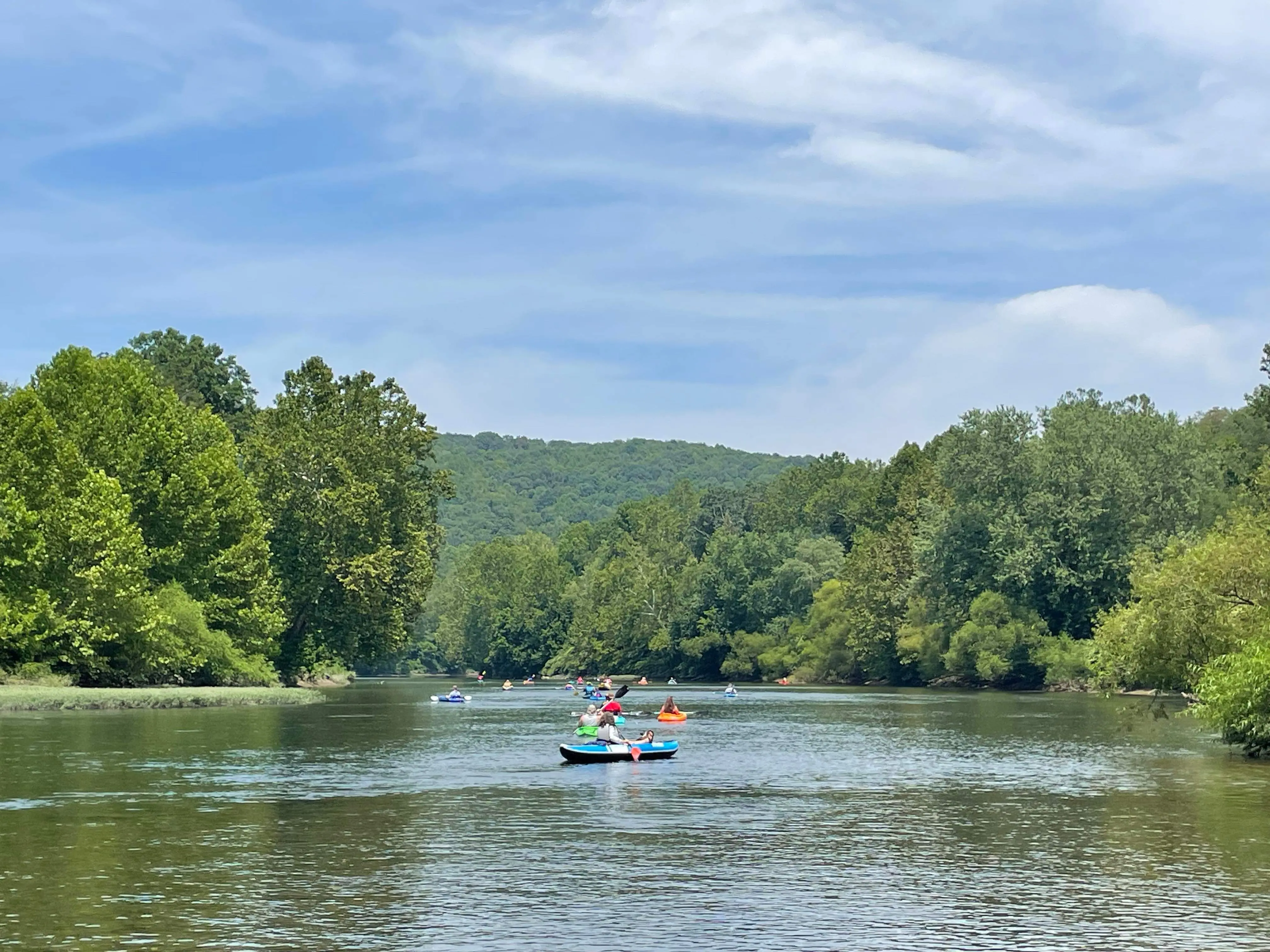
The Buckhannon and Tygart Valley River Water Trail is a 45 mile route originating near Sago in Upshur County and ending near Arden in Barbour County. The Water Trail includes approximately 30 miles of the Buckhannon River and 15 miles of the Tygart Valley River. The trail is mostly flatwater with occasional riffles, offering excellent beginner and family friendly routes. The proposed Water Trail flows through peaceful landscapes, quiet meanders, and mature forested landscapes, as well as communities rich in history, including two historic covered bridges.
The BTV Water Trail is officially designated as a WV Water Trail by the WV Recreational Trail Advisory Board. The Water Trail was approved for designation in December 2024 after nearly a year-long planning, assessment, and application process.
The Buckhannon River Watershed Association (BRWA) and Save the Tygart Watershed Association (STTWA) are the primary co-sponsors for the BTV Water Trail. Both BRWA and STTWA are 501(c)3 non-profit organizations dedicated to protecting and restoring our local waterways. BRWA and STTWA cohesively believe our waterways are major natural assets, and our need for clean water should be a source of community unity. Both organizations have been working for decades to restore and promote the outstanding potential of our waterways. Both organizations have implemented and maintained numerous acid mine drainage treatment systems, as well as other clean water protection projects to restore our rivers for the enjoyment of all. We hope the establishment of a Water Trail can be a way to enhance recreational opportunities and general appreciation of the river, leading to increased support of conservation efforts.
A Water Trail is a sponsored and maintained recreational route along a waterway that is promoted by local entities with publicly accessible access points. The Water Trail is a navigable route for canoes, kayaks, stand up paddle boards, and other non-motorized recreational boaters. Along the way, there is a network of publicly accessible areas where river users can park vehicles and access the river. River access sites are spaced apart so that the section of river may be paddled in a few hours or a full day (3 - 7 miles apart). The Water Trail provides a unique perspective to experience the landscape from the river’s view, while enjoying scenic, educational, historical, and cultural points of interest. A Water Trail promotes Leave No Trace principle, respect for private landowners, proper river safety, and fishing and boating regulations.
Watershed & River Profiles
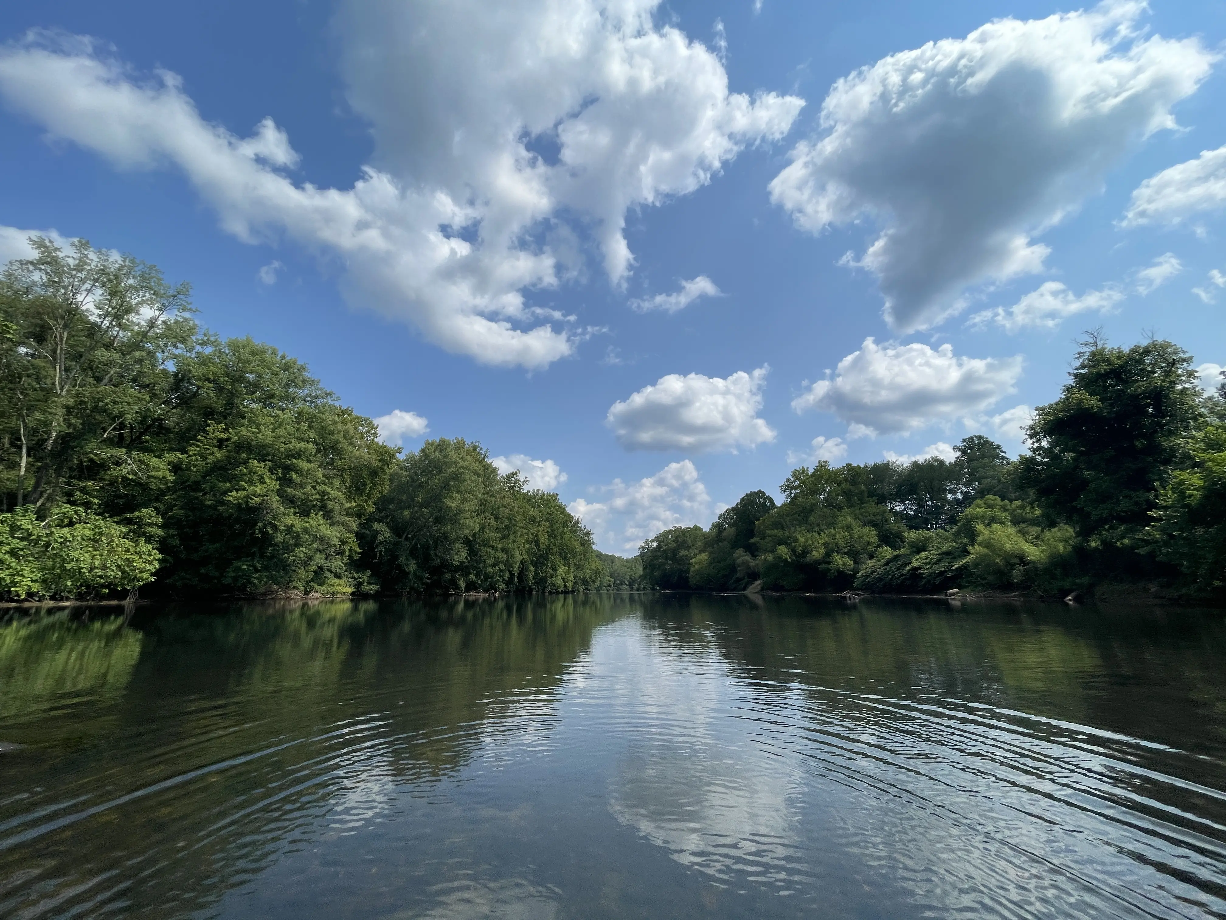
Both the Buckhannon and Tygart Valley Rivers originate in the elevated Allegheny mountains of central West Virginia. Both rivers flow through the Forested Hills and Mountain ecoregion. Characterized by rugged topography and rich woodlands, numerous small tributaries carve the crumbled landscapes and feed the mainstem rivers that are guarded by steep slopes and exposed cliff faces. Both rivers flow in a general northern direction. The Buckhannon River is 45 miles long and joins the Tygart Valley River south of Philippi at the Tygart Junction. The Tygart Valley River continues its journey until it joins the West Fork River in Fairmont to form the Monongahela River, which flows into the Ohio River in Pittsburgh, PA. Eventually, the water flows to the Mississippi river and empties into the Gulf of Mexico.
Nature & Wildlife
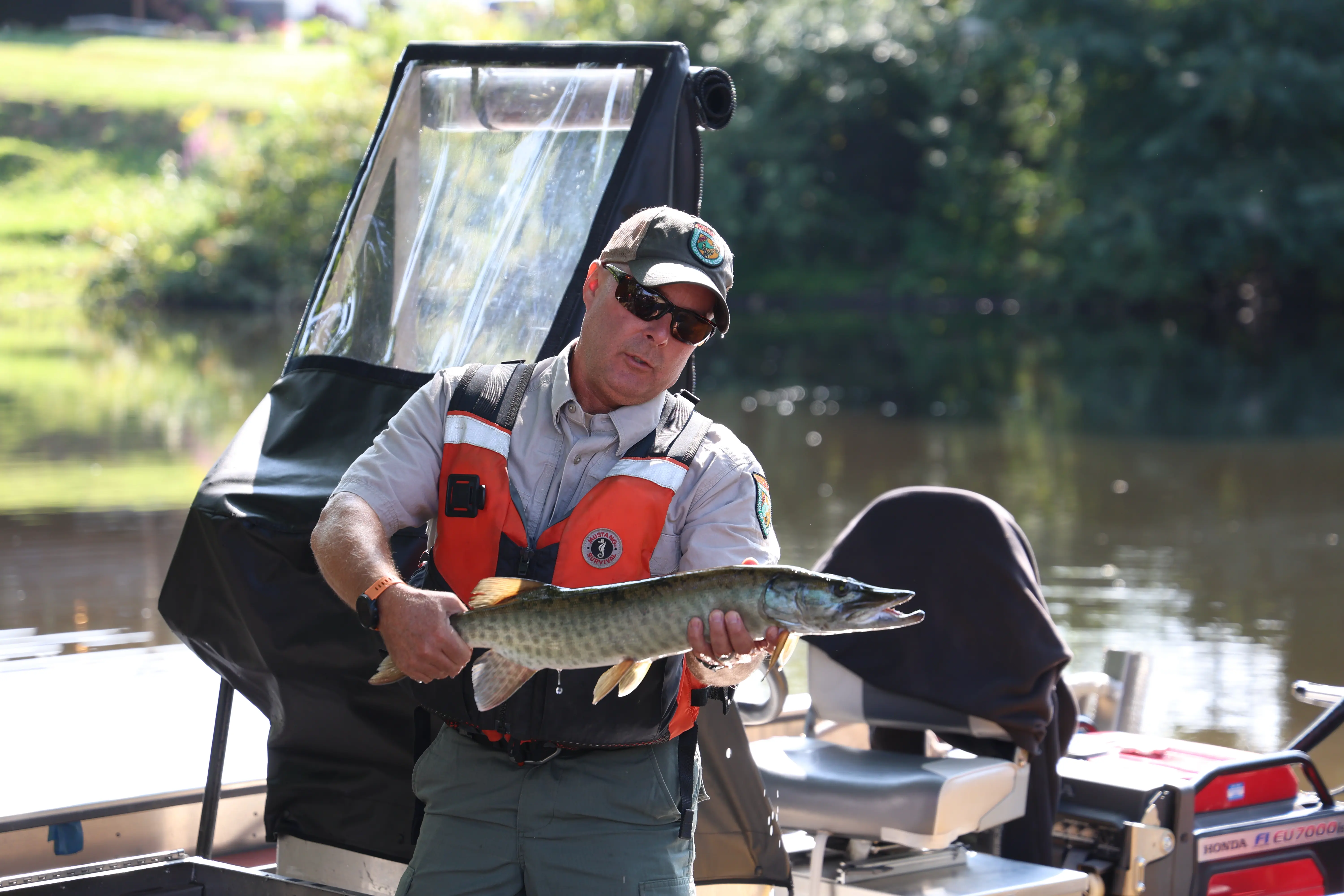
Mature forested communities dominate the riparian area along the riverway. Large maples, black cherry, ash, elms, and sycamore trees stand tall along the river banks. Numerous types of wildlife and fish call the river and the surrounding riparian area home. Birds utilize the river as a corridor, and the tall mature trees along the river are used as habitat. Hawks, king fishers, blue and green herons, wood ducks, mallards, and bald eagles are commonly seen while paddling. Mammals such as chipmunk, squirrel, river otter, groundhog, muskrat, and foxes can also be seen scurrying along the river banks or swimming in the water. In the warmer weather, turtles, frogs, and salamanders bask in the sun, and butterflies, dragonflies, and damselflies can be heard buzzing around. Spring ephemerals and summer wildflowers are especially plentiful alongside the river. Fishing opportunities are also excellent. The Buckhannon River is well-known as one of the best locations for musky fishing in the state. The WVDNR stocks brook, brown, and rainbow trout twice a year on a 20 mile segment of the Buckhannon River. Other common fish include smallmouth and largemouth bass, and bluegill.
History & Culture
The region is rich in social, cultural, and historical heritage. Many indigenous tribes used this area for hunting and gathering, as well as traveling between other lands. Calicuas, Massawomek, Shawandasse, S’atsoyaha, and Osage are among the many indigenous tribes that are recognized to have lived in this area. Buckongahelas of the Lenape Delaware tribe traveled from what is now considered Delaware eastward, and lived for a time in the area that is now Buckhannon in Upshur County, WV.
Samuel and John Pringle were the first European settlers of Upshur County, arriving in 1762 and living along the Buckhannon River. The brothers even hid in a giant hollow Sycamore for two years evading the British Army. The Monongahela River and its upper tributaries were the main highways for European settlement in the coming decades. After more settlers arrived, several small communities were formed along the Buckhannon River. The land was cleared for farming, and the timber was used to build rail lines. As communities grew, lumbering became the primary industry and several grist mills were constructed. Today, ghost towns are common along the Buckhannon River where mills once stood including Beans Mill and Ours Mills. In the early stages of the Civil War during the summer of 1861, many troops were stationed in the Buckhannon/Philippi region. The Battle of Philippi occurred on June 3, 1861 and is recognized as the first organized land battle of the Civil War. At the turn of the twentieth century, the coal industry began to grow leading to many large deep mines and strip mines. The oil and gas industry began to grow a few decades later.
The rich human history in the region has negatively impacted the environment and natural resources in the watershed. For over two decades, concerned citizens of Save the Tygart Watershed Association and Buckhannon River Watershed Association have focused grassroots efforts to improve water quality. Many conservation threats still remain. Restoration and protection of the riverway is an on-going effort.